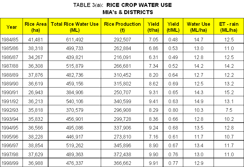
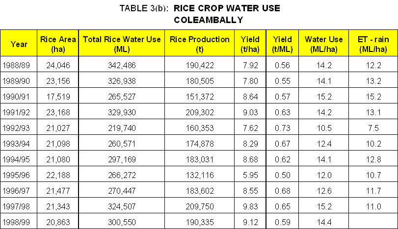
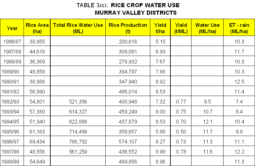
In the Areas and Districts water usage on rice crops has been measured for many years for the purpose of environmental monitoring. Data on rice crop water use are contained in Tables 3(a), 3(b) and 3(c).
For comparative purposes an estimate of evapotranspiration during the rice-growing season (i.e. ET less rain) is included.
Broadly it can be seen for the MIA's and Districts and Coleambally that there has been a decline in unit rice crop water use. Contributors to this decline would include changes in drainage practices, better techniques for identifying leaky soils, increasing landholder awareness, farm planning and practices and higher water tables.
A similar trend is expected in the Murray districts but cannot be confirmed because of a lack of data.
There are also regional differences with the Murray Valley displaying the lowest unit use. This probably occurs because soil testing has been carried out for a longer period and farmers have always been compelled to retain all tailwater, a practice made compulsory in Murrumbidgee and Coleambally in relatively recent years.
Coleambally shows the highest unit use. This is associated with a greater proportion of the irrigated area being underlain by relatively deep watertables. Thus the equilibrium state reached in the MIA many years ago is not yet evident in much of Coleambally.
Data on rice crop water use are not collected for licensed diverters.