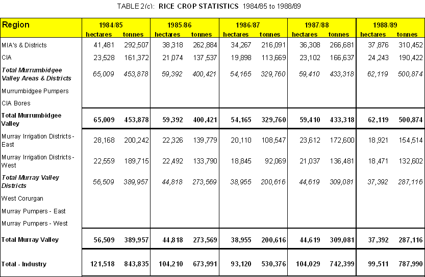
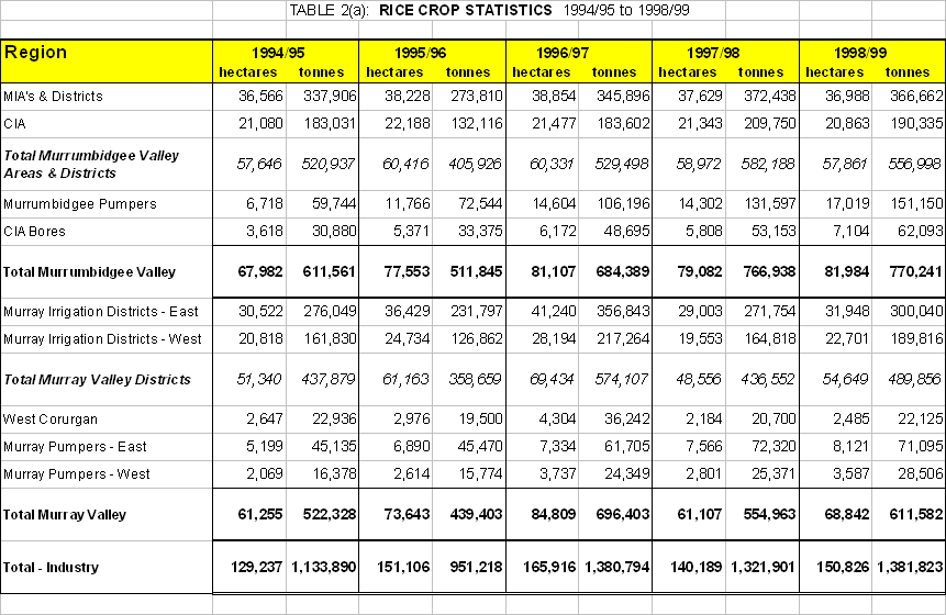
Full statistics on regional rice production are included in Tables 2(a), 2(b) and 2(c).
Examination of the data show that over the last decade the growth in total production has mostly occurred through expansion of ricegrowing outside the traditional ricegrowing irrigation Areas and Districts, i.e. on to properties on the river and creek systems.
At the risk of being over-simplistic the production situation for the last 3 crops (each of which have been in excess of 1.3 million tonnes) can be approximately described as follows: -
Region |
Approximate Production ( ` 000 t) |
Murrumbidgee Valley Areas & Districts |
500 |
At the commencement of the current decade the production from the last three regions was effectively zero.
From all the Areas and Districts the production potential for the decade has been about the same. The two main causes of variability have been area sown (governed by availability of water, particularly in the Murray Valley) and crop yield (cold temperatures at flowering, for example, being the main cause of the low yields for the 1996 crop).
It is important to recognise where current production potential lies. The above approximation shows that in the Areas and Districts the amount of rice that can be sown has peaked and total production can only grow through an increase in field yields - provided the regions' sustainability for ricegrowing is mainframed.
In the other regions there may still be potential for further growth by attracting new participants - i.e. water used for other purposes being allocated to rice. However, given the restraints on irrigation activities that have developed or are developing, as discussed later in this paper it is difficult to envisage total rice sowings exceeding the peak of 166,000 ha that occurred in 1996/97.
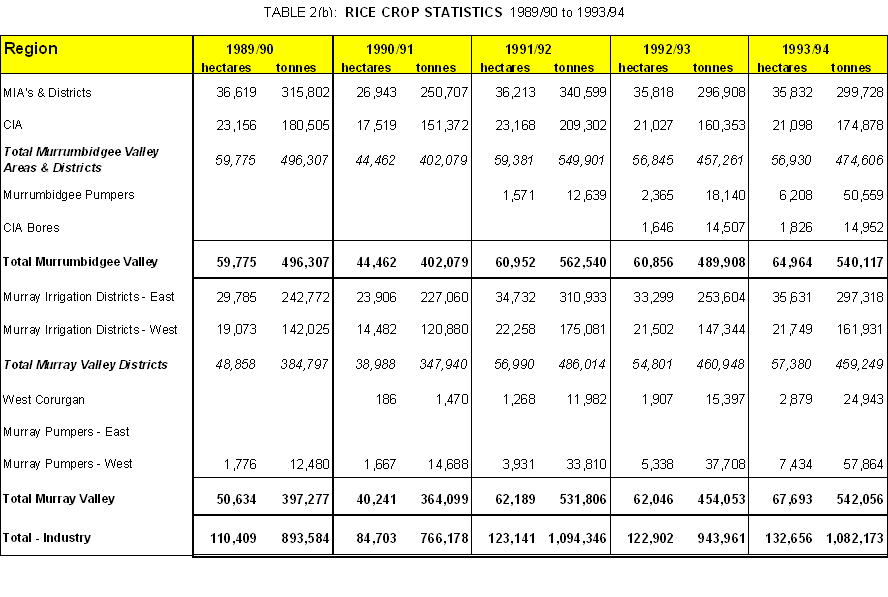 Note: - Table 2(a) and 2(b). The Murrumbidgee Region includes those who derive water from the Murrumbidgee River, Yanko and Billabong Creeks. In these tables they are separated into Murrumbidgee Pumpers and Murray Pumpers East.